Management of Forests and Urban Green Areas
The ForestVISION project aims to develop an innovative online platform for intelligent forest monitoring, analysis, and sustainable management using artificial intelligence (AI) and computer vision. The platform employs AI to classify flora (it focuses on two species and their deviations from optimal status) in a forest ecosystem, and analyse observable conditions. It offers early warnings on various aspects like size, composition, health, and potential risks such as illegal deforestation. The project focuses primarily on the Beiras and Serra da Estrela area, Beira Baixa in Portugal.
Utilizing data captured by satellites and drones, including RGB and hyper/multi-spectral imagery, as well as ground sensors like temperature and humidity sensors.
The platform aims to facilitate sustainable forest management by comparing reforestation methods, tree varieties, and monitoring factors that may lead to disasters. It contributes to scientific-technological cooperation between cross-border entities and aims to enhance local resources. ForestVISION helps to prevent natural hazards, adapt to climate changes, and efficiently manage ecosystem services in a more sustainable way, promoting social, environmental, and economic regeneration.
River Ecosystem Management
Invasive aquatic Plants detection
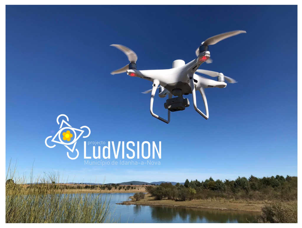
LudVision is a proof of concept project for Remote Detection of an Invasive Aquatic Floral Species using Drone-Captured Multispectral Data. The main targeted species was Ludwigia peploides, which is an invasive species that raises concern at the European level, due to its negative impact on the natural balance native ecosystems.
The project fits under the Remote Sensing umbrella, and relies on heavily modified state-of-the-art semantic segmentation models, to detect the presence of the invasive species in drone-captured multispectral images. The model is able to detect the species with high accuracy in a wide range of altitudes, and it is tolerant to variability in both atmospheric and light conditions.
This project was developed in partnership with UBI (Universidade da Beira Interior) and co-funded by NOVA LINCS (UIDB/04516/2020) with the financial support of FCT – Fundação para a Ciência e a Tecnologia, through portuguese national funds.
Biodiversity Artificial Intelligence Hub (BAIH)
In collaboration with the National Biodiversity Future Center (NBFC) and the Consiglio Nazionale delle Ricerche (CNR), we are developing a digital platform for biodiversity, designed to enable data sharing, analytical reporting, and citizen science tools. Leveraging AI models and Big Data processing, the platform will support research teams, universities, and professionals in biodiversity studies.
The portal will serve as a central hub for AI-driven biodiversity research, integrating models, datasets, code, and publications. Designed to be modular, scalable, and interoperable, the platform will provide templates, guides, and tutorials, streamlining workflows and accelerating innovation.
It will also function as a demonstrator of innovative services, including monitoring the risks and dynamics of Invasive Alien Species in protected areas. The pilot deployment will be hosted in the Parco delle Alpi Marittime, serving as a real-world testing ground for biodiversity research applications.

Precision Agriculture
ZIRAK participated in a European Precision Agriculture project called ATLAS, which focused on several aspects, including the interfacing of existing tractors with embedded hardware and the management of soil samples for laboratory analysis. ZIRAK also worked on prototypes for tractor geo-fencing, both on embedded hardware and mobile applications connected to the tractor, enabling simplified fleet management.
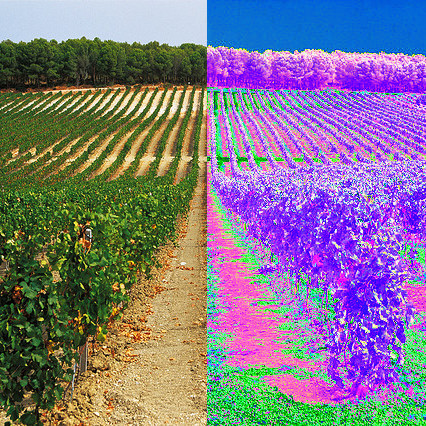
ZIRAK provides tailored services for analyzing large agricultural plots, vineyards, and orchards, where it can assess the specific needs of plants, issue alerts in case of significant variations in water, nutrients, or certain diseases detectable through multispectral cameras. The services can also include predictions of basic parameters, such as water stress, leveraging drones and/or satellites to accommodate different requirements.

